Geolocate

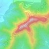
Malhargad topographic map

Click on the map to display elevation.

About this map

Name: Malhargad topographic map, elevation, terrain.

Location: Malhargad, Purandhar, Pune District, Maharashtra, India (18.41196 74.04930 18.41206 74.04940)

Average elevation: 2,703 ft

Minimum elevation: 2,139 ft

Maximum elevation: 3,228 ft

Other topographic maps

Click on a map to view its topography, its elevation and its terrain.
Purandar Fort

India > Maharashtra > Purandhar > Narayanpur

Average elevation: 3,369 ft

Purandar Fort

India > Maharashtra > Purandhar > Narayanpur

Average elevation: 3,369 ft

Gear up for your next adventure:

🛠️Outdoor Gear Repair Kit - Essential tools to fix gear on the trail
🪵Folding Camp Saw - Compact saw for wood and campsite work
🪶Camping Sleeping Pad - Comfortable sleeping pad for backpacking
🧦Merino Wool Socks - Moisture-wicking, blister-preventing socks for long treks
🛌Ultralight Sleeping Bags - Compact down bags for cold nights in the wilderness

As an Amazon Associate, this site earns from qualifying purchases at no extra cost to you.