Geolocate

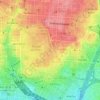
Trafalgar topographic map

Click on the map to display elevation.

About this map

Name: Trafalgar topographic map, elevation, terrain.

Location: Trafalgar, Chamberí, Madrid, Community of Madrid, 28010, Spain (40.42763 -3.70581 40.43867 -3.69575)

Average elevation: 2,241 ft

Minimum elevation: 1,952 ft

Maximum elevation: 2,352 ft

Other topographic maps

Click on a map to view its topography, its elevation and its terrain.
Madrid

Spain > Community of Madrid > Madrid

Average elevation: 2,133 ft

Fuente de las Gaviotas

Spain > Community of Madrid > Madrid

Average elevation: 2,149 ft

Gear up for your next adventure:

🌄Hiking Binoculars - Compact binoculars for scenic views and trail spotting
🪓Survival Multi‑Tool - Versatile tool for camp and trail tasks
🥄Camping Utensil Set - Lightweight utensils for outdoor meals
💧Water Purification System - Clean water on the trail with reliable purifiers
⛺Backpacking Tents - Weight-optimized shelters for multi-day topographic surveys

As an Amazon Associate, this site earns from qualifying purchases at no extra cost to you.