Geolocate

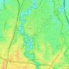
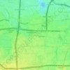
Kuningan Timur topographic map

Click on the map to display elevation.

About this map

Name: Kuningan Timur topographic map, elevation, terrain.

Location: Kuningan Timur, Setiabudi, South Jakarta, Special Capital Region of Jakarta, Indonesia (-6.24090 106.82083 -6.22402 106.83680)

Average elevation: 59 ft

Minimum elevation: 20 ft

Maximum elevation: 141 ft

Other topographic maps

Click on a map to view its topography, its elevation and its terrain.
Gear up for your next adventure:

🧦Hiking Socks - Comfortable socks to prevent blisters on long hikes
🪑Ultralight Camp Chairs - Portable seating for resting after a long day of mapping
🧴Hand Sanitizer - Keep hands clean while hiking
🎒Hydration Pack - Hands‑free water reservoir for long hikes
🧣Merino Neck Gaiters - Multi-functional headwear for wind and sun protection

As an Amazon Associate, this site earns from qualifying purchases at no extra cost to you.