Geolocate

Lapok topographic map

Click on the map to display elevation.

About this map
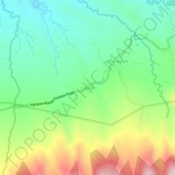
Name: Lapok topographic map, elevation, terrain.

Location: Lapok, Talakag, Bukidnon, Northern Mindanao, 8708, Philippines (7.99438 124.76434 8.03438 124.80434)

Average elevation: 4,741 ft

Minimum elevation: 4,075 ft

Maximum elevation: 5,981 ft

Other topographic maps

Click on a map to view its topography, its elevation and its terrain.
Cagayan de Oro River

Philippines > Bukidnon > Talakag > San Isidro

Average elevation: 1,030 ft

Gear up for your next adventure:

🕶️Glacier Sunglasses - Side shields to protect eyes from high-altitude snow glare
🕶️GPS Smartphone Mount - Secure mount for phone navigation
🌄Hiking Binoculars - Compact binoculars for scenic views and trail spotting
🧥Waterproof Jacket for Hiking - Breathable and rugged rain jacket for outdoor excursions
🎒Hydration Pack - Hands‑free water reservoir for long hikes

As an Amazon Associate, this site earns from qualifying purchases at no extra cost to you.