
Marienberg topographic map
Interactive map
Click on the map to display elevation.
About this map
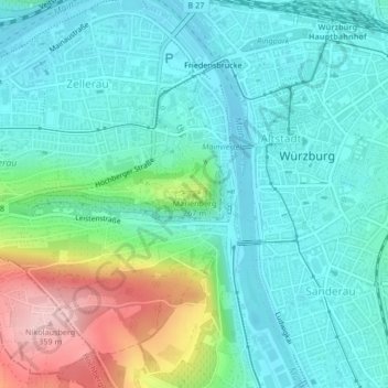
Name: Marienberg topographic map, elevation, terrain.
Location: Marienberg, Würzburg, Lower Franconia, Bavaria, 97082, Germany (49.78969 9.92078 49.78979 9.92088)
Average elevation: 702 ft
Minimum elevation: 545 ft
Maximum elevation: 1,188 ft
Other topographic maps
Click on a map to view its topography, its elevation and its terrain.