Geolocate

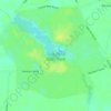
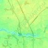
Cedar Beach topographic map

Click on the map to display elevation.

About this map

Name: Cedar Beach topographic map, elevation, terrain.

Location: Cedar Beach, Sussex County, Delaware, United States (38.91536 -75.33765 38.95536 -75.29765)

Average elevation: 0 ft

Minimum elevation: -13 ft

Maximum elevation: 13 ft

Sussex County trails, hiking, mountain biking, running and outdoor activities

Other topographic maps

Click on a map to view its topography, its elevation and its terrain.
Millville

United States > Delaware > Sussex County

Average elevation: 16 ft

Fenwick Island

United States > Delaware > Sussex County

Average elevation: 0 ft

Henlopen Acres

United States > Delaware > Sussex County

Average elevation: 23 ft

Bethel

United States > Delaware > Sussex County

Average elevation: 26 ft

Dagsboro

United States > Delaware > Sussex County

Average elevation: 30 ft

Blades

United States > Delaware > Sussex County

Average elevation: 23 ft

Bridgeville

United States > Delaware > Sussex County

Average elevation: 43 ft

Laurel

United States > Delaware > Sussex County

Average elevation: 36 ft

Gear up for your next adventure:

🌡️Handheld Weather Meters - Measure wind, temp, and pressure for safe mountain travel
🥾Women's Hiking Boots - Top-rated trail boots with ankle support and superior grip
📷Action Cameras - Rugged cameras to document your journeys across rugged terrain
🍳Camping Cook Set - Complete cookware for outdoor meals
❄️Traction Cleats - Prevent slips on icy trails during winter hikes

As an Amazon Associate, this site earns from qualifying purchases at no extra cost to you.