Geolocate

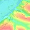
Stepok topographic map

Click on the map to display elevation.

About this map

Name: Stepok topographic map, elevation, terrain.

Location: Stepok, Барвінківська міська громада, Izium Raion, Kharkiv Oblast, Ukraine (49.08805 36.83789 49.10279 36.85259)

Average elevation: 249 ft

Minimum elevation: 230 ft

Maximum elevation: 315 ft

Other topographic maps

Click on a map to view its topography, its elevation and its terrain.

Бузове Друге

Ukraine > Kharkiv Oblast

Average elevation: 617 ft

Kostiantynivka

Ukraine > Kharkiv Oblast

Average elevation: 466 ft

Donets

Ukraine > Kharkiv Oblast

Average elevation: 315 ft

Andriivka

Ukraine > Kharkiv Oblast

Average elevation: 308 ft

Kostiantynivka

Ukraine > Kharkiv Oblast

Average elevation: 466 ft

Andriivka

Ukraine > Kharkiv Oblast

Average elevation: 308 ft

Donets

Ukraine > Kharkiv Oblast

The Donets originates on the Central Russian Upland, near Podolkhi village, Prokhorovka area, north of Belgorod, at an elevation of 200 m (660 ft) above sea level. Its basin contains over 3000 rivers, of which 425 are longer than 10 km (6.2 mi) and 11 are longer than 100 km (62 mi); 1011 of those rivers…

Average elevation: 420 ft
Sakhnovshchyna

Ukraine > Kharkiv Oblast

Average elevation: 522 ft

Levkivka

Ukraine > Kharkiv Oblast

Average elevation: 331 ft

Andriivka

Ukraine > Kharkiv Oblast

Average elevation: 308 ft

Andriivka

Ukraine > Kharkiv Oblast

Average elevation: 308 ft

Gear up for your next adventure:

🪵Folding Camp Saw - Compact saw for wood and campsite work
🧣Hiking Neck Gaiter - Multi‑use neck protection for outdoor weather
🍳Camping Cook Set - Complete cookware for outdoor meals
🧣Merino Neck Gaiters - Multi-functional headwear for wind and sun protection
🏕️Family Camping Gear - Essentials for group camping trips

As an Amazon Associate, this site earns from qualifying purchases at no extra cost to you.