Geolocate

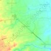
San Jose topographic map

Click on the map to display elevation.

About this map

Name: San Jose topographic map, elevation, terrain.

Location: San Jose, Rosario, Batangas, Calabarzon, 4225, Philippines (13.81549 121.21412 13.85549 121.25412)

Average elevation: 427 ft

Minimum elevation: 381 ft

Maximum elevation: 492 ft

Other topographic maps

Click on a map to view its topography, its elevation and its terrain.
Pinagsibaan

Philippines > Batangas > Rosario

Average elevation: 187 ft

Gear up for your next adventure:

🌄Hiking Binoculars - Compact binoculars for scenic views and trail spotting
🧭Map Reading Tools - Tools and kits for map navigation
🪶Multi‑Purpose Knife - Useful blade for camp and trail
🔭Telescopic Hiking Pole - Adjustable pole for hiking stability
👖Convertible Hiking Pants - Versatile zip-off pants for changing altitudes and temperatures

As an Amazon Associate, this site earns from qualifying purchases at no extra cost to you.