Geolocate

Baghola topographic map

Click on the map to display elevation.

About this map

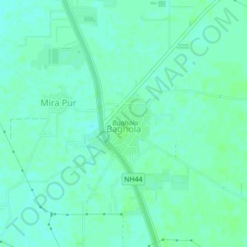
Name: Baghola topographic map, elevation, terrain.

Location: Baghola, Palwal, Haryana, India (28.20579 77.30128 28.21314 77.30975)

Average elevation: 643 ft

Minimum elevation: 630 ft

Maximum elevation: 650 ft

Gear up for your next adventure:

🌲Outdoor Survival Books - Best books on survival skills
🚑Emergency Bivvies - Heat-reflective sleeping bags for survival situations
🌎3D Topographic Globes - Raised relief globes for a tactile understanding of geography
🦟Ultrasonic Repellers - Create a bug-free zone at your camp or rest stop
👟Men's Trail Runners - Lightweight footwear for fast-paced exploration and light hiking

As an Amazon Associate, this site earns from qualifying purchases at no extra cost to you.