Geolocate

Otta topographic map

Click on the map to display elevation.

About this map

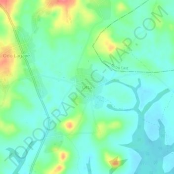
Name: Otta topographic map, elevation, terrain.

Location: Otta, Ogun State, Nigeria (6.70602 3.97970 6.74602 4.01970)

Average elevation: 89 ft

Minimum elevation: 26 ft

Maximum elevation: 246 ft

Other topographic maps

Click on a map to view its topography, its elevation and its terrain.

Ifo

Nigeria > Ogun State

Average elevation: 135 ft

Odeda

Nigeria > Ogun State

Average elevation: 423 ft

Ado Odo/Ota

Nigeria > Ogun State

Average elevation: 105 ft

Ijebu Ode

Nigeria > Ogun State

Average elevation: 141 ft

Ikenne

Nigeria > Ogun State

Average elevation: 230 ft

Ogun Waterside

Nigeria > Ogun State

Average elevation: 39 ft

Shagamu

Nigeria > Ogun State

Average elevation: 171 ft

Ijebu North East

Nigeria > Ogun State

Average elevation: 230 ft

Odeda

Nigeria > Ogun State

Average elevation: 423 ft

Ado Odo/Ota

Nigeria > Ogun State

Average elevation: 105 ft

Odeda

Nigeria > Ogun State

Average elevation: 423 ft

Shagamu

Nigeria > Ogun State

Average elevation: 171 ft

Abeokuta South

Nigeria > Ogun State

Average elevation: 318 ft

Gear up for your next adventure:

🚁Photography Drones - Capture stunning aerial views of landforms and topography
📦Dry Bags Set - Waterproof storage for electronics and clothes
GPS Sports Watch - GPS watch for running, hiking and training
📻Weather Alert Radios - Stay informed of storm risks while off-the-grid
🛠️Backpacking Tool Kit - Essential toolkit for outdoor repairs

As an Amazon Associate, this site earns from qualifying purchases at no extra cost to you.