
Thank you for supporting this site ❤️
Make a donation
Make a donation
Gear up for your next adventure:
As an Amazon Associate, this site earns from qualifying purchases at no extra cost to you.
Ottersberg topographic map
Click on the map to display elevation.
Thank you for supporting this site ❤️
Make a donation
Make a donation
Gear up for your next adventure:
As an Amazon Associate, this site earns from qualifying purchases at no extra cost to you.
About this map
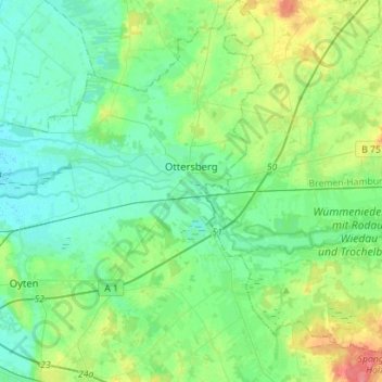
Name: Ottersberg topographic map, elevation, terrain.
Location: Ottersberg, Landkreis Verden, Lower Saxony, 28870, Germany (53.01582 8.94724 53.18452 9.20464)
Average elevation: 59 ft
Minimum elevation: 10 ft
Maximum elevation: 203 ft
Thank you for supporting this site ❤️
Make a donation
Make a donation
Gear up for your next adventure:
As an Amazon Associate, this site earns from qualifying purchases at no extra cost to you.