
Thank you for supporting this site ❤️
Make a donation
Make a donation
Gear up for your next adventure:
As an Amazon Associate, this site earns from qualifying purchases at no extra cost to you.
Mier y Terán topographic map
Click on the map to display elevation.
Thank you for supporting this site ❤️
Make a donation
Make a donation
Gear up for your next adventure:
As an Amazon Associate, this site earns from qualifying purchases at no extra cost to you.
About this map
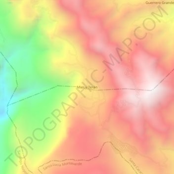
Name: Mier y Terán topographic map, elevation, terrain.
Location: Mier y Terán, San Esteban Atatlahuca, Oaxaca, Mexico (17.00306 -97.73083 17.04306 -97.69083)
Average elevation: 8,389 ft
Minimum elevation: 5,551 ft
Maximum elevation: 10,282 ft
Thank you for supporting this site ❤️
Make a donation
Make a donation
Gear up for your next adventure:
As an Amazon Associate, this site earns from qualifying purchases at no extra cost to you.