Geolocate

Malgas topographic map

Click on the map to display elevation.

About this map

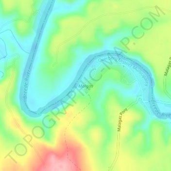
Name: Malgas topographic map, elevation, terrain.

Location: Malgas, Swellendam Ward 3, Swellendam Local Municipality, Western Cape, South Africa (-34.30461 20.57551 -34.29496 20.59025)

Average elevation: 154 ft

Minimum elevation: 3 ft

Maximum elevation: 413 ft

Other topographic maps

Click on a map to view its topography, its elevation and its terrain.

Gear up for your next adventure:

🏕️Tent Footprint - Protect your tent base from wear
🔦LED Headlamp - Bright and durable LED headlamp for night navigation
🥾Hiking Shoes - Durable and comfortable shoes for trail hiking
🧯Portable Fire Pit - Compact fire pit for camping spots
🧼Biodegradable Camping Soap - Eco‑friendly soap for outdoor hygiene

As an Amazon Associate, this site earns from qualifying purchases at no extra cost to you.