
Thank you for supporting this site ❤️
Make a donation
Make a donation
Gear up for your next adventure:
As an Amazon Associate, this site earns from qualifying purchases at no extra cost to you.
Belide topographic map
Click on the map to display elevation.
Thank you for supporting this site ❤️
Make a donation
Make a donation
Gear up for your next adventure:
As an Amazon Associate, this site earns from qualifying purchases at no extra cost to you.
About this map
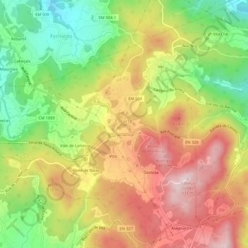
Name: Belide topographic map, elevation, terrain.
Location: Belide, Escariz, Arouca, Aveiro, 4540-320, Portugal (40.91983 -8.42298 40.95983 -8.38298)
Average elevation: 1,430 ft
Minimum elevation: 827 ft
Maximum elevation: 2,014 ft
Thank you for supporting this site ❤️
Make a donation
Make a donation
Gear up for your next adventure:
As an Amazon Associate, this site earns from qualifying purchases at no extra cost to you.