
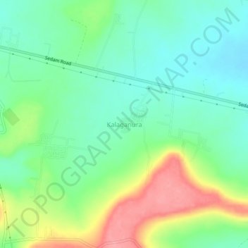
Kalaganura topographic map
Interactive map
Click on the map to display elevation.
About this map
Name: Kalaganura topographic map, elevation, terrain.
Average elevation: 1,624 ft
Minimum elevation: 1,512 ft
Maximum elevation: 1,834 ft
Other topographic maps
Click on a map to view its topography, its elevation and its terrain.
Kalaburagi
India > Karnataka > Kalaburagi taluku
Kalaburagi, Kalaburagi taluku, Kalaburagi District, Karnataka, 585101, India
Average elevation: 1,526 ft
Melakunda
India > Karnataka > Kalaburagi taluku
Melakunda, Kalaburagi taluku, Kalaburagi District, Karnataka, India
Average elevation: 1,444 ft