
Kalaburagi topographic map
Click on the map to display elevation.
Kalaburagi
The entire district is on the Deccan Plateau, and the elevation ranges from 300 to 750 m above MSL. Two main rivers, the Krishna and Bhima, flow through the district. The predominant soil type is black soil. The district has many tanks, which irrigate the land along with the river. The Upper Krishna Project is a major irrigation venture in the district of Kalaburagi. The main crops are groundnuts, rice, and pulses. Kalaburagi is the largest producer of toor dal, or pigeon peas, in Karnataka. Kalaburagi is an industrially backward district but is showing signs of growth in the cement, textile, leather,chemical and glass processing industries. Kalaburagi has a university with Medical and Engineering Colleges. Central University of Karnataka (CuK) is located in Kadaganchi, Åland Taluk of Kalaburagi. The geographical area of the city is 64 square kilometres.
About this map
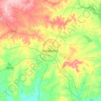
Name: Kalaburagi topographic map, elevation, terrain.
Average elevation: 1,526 ft
Minimum elevation: 1,263 ft
Maximum elevation: 1,909 ft