Geolocate

Cloverdale topographic map

Click on the map to display elevation.

About this map

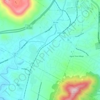
Name: Cloverdale topographic map, elevation, terrain.

Location: Cloverdale, Botetourt County, Virginia, United States (37.33791 -79.92953 37.37844 -79.88093)

Average elevation: 1,316 ft

Minimum elevation: 1,020 ft

Maximum elevation: 2,290 ft

Botetourt County trails, hiking, mountain biking, running and outdoor activities

Gear up for your next adventure:

🥇GPS Hiking Watch - Multi‑sport GPS watch with navigation and trail tracking
💧Water Purification System - Clean water on the trail with reliable purifiers
🌲Outdoor Survival Books - Best books on survival skills
🛰️Satellite Messengers - Emergency SOS and two-way messaging for off-grid adventures
🦶Carbon Trekking Poles - Reduce knee impact on steep descents with ultra-light poles

As an Amazon Associate, this site earns from qualifying purchases at no extra cost to you.