
Red Bay topographic map
Interactive map
Click on the map to display elevation.
About this map
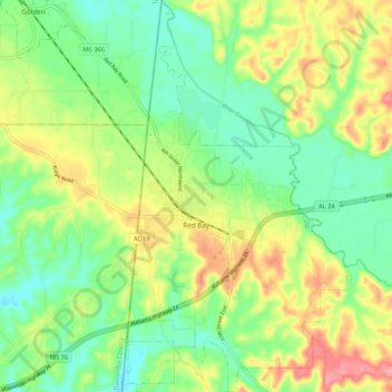
Name: Red Bay topographic map, elevation, terrain.
Location: Red Bay, Franklin County, Alabama, 35582, United States (34.40380 -88.16156 34.49073 -88.10255)
Average elevation: 581 ft
Minimum elevation: 463 ft
Maximum elevation: 755 ft
Franklin County trails, hiking, mountain biking, running and outdoor activities
Other topographic maps
Click on a map to view its topography, its elevation and its terrain.