
Thank you for supporting this site ❤️
Make a donation
Make a donation
Gear up for your next adventure:
As an Amazon Associate, this site earns from qualifying purchases at no extra cost to you.
Kibeho topographic map
Click on the map to display elevation.
Thank you for supporting this site ❤️
Make a donation
Make a donation
Gear up for your next adventure:
As an Amazon Associate, this site earns from qualifying purchases at no extra cost to you.
About this map
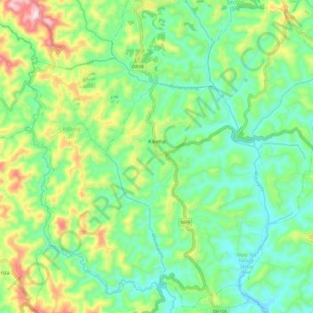
Name: Kibeho topographic map, elevation, terrain.
Location: Kibeho, Nyaruguru District, Southern Province, Rwanda (-2.70497 29.51235 -2.59875 29.62297)
Average elevation: 6,155 ft
Minimum elevation: 5,728 ft
Maximum elevation: 7,080 ft
Thank you for supporting this site ❤️
Make a donation
Make a donation
Gear up for your next adventure:
As an Amazon Associate, this site earns from qualifying purchases at no extra cost to you.