
Olot topographic map
Interactive map
Click on the map to display elevation.
About this map
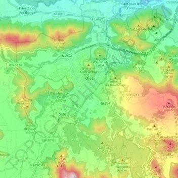
Name: Olot topographic map, elevation, terrain.
Location: Olot, Garrotxa, Gerona, España (42.14974 2.44638 42.20532 2.54909)
Average elevation: 1,637 ft
Minimum elevation: 961 ft
Maximum elevation: 2,890 ft
Other topographic maps
Click on a map to view its topography, its elevation and its terrain.
Turó de la Rovira
Turó de la Rovira, Santa Pau, Garrotxa, Gerona, 17811, España
Average elevation: 2,264 ft
Volcà del Croscat
Volcà del Croscat, Olot, Garrotxa, Gerona, 17811, España
Average elevation: 2,028 ft