Geolocate

Nettuno topographic map

Click on the map to display elevation.

About this map

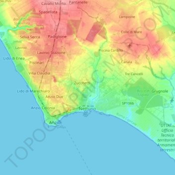
Name: Nettuno topographic map, elevation, terrain.

Location: Nettuno, Roma Capitale, Lazio, 00048, Italy (41.40761 12.61904 41.53935 12.77804)

Average elevation: 92 ft

Minimum elevation: 0 ft

Maximum elevation: 282 ft

Other topographic maps

Click on a map to view its topography, its elevation and its terrain.

Tivoli Terme

Italy > Lazio > Roma Capitale

Average elevation: 217 ft

Lido di Ostia

Italy > Lazio > Roma Capitale > Rome

Average elevation: 7 ft

Gear up for your next adventure:

🧭Pro Hiking Compasses - High-accuracy liquid-filled compasses for topographic orientation
🗺️Topographic Maps - Detailed topo maps for hiking, exploring and outdoor navigation
🧴Hand Sanitizer - Keep hands clean while hiking
🌎3D Topographic Globes - Raised relief globes for a tactile understanding of geography
👟Trail Running Shoes - Lightweight shoes for trail runners

As an Amazon Associate, this site earns from qualifying purchases at no extra cost to you.