Geolocate

Forbach topographic map

Click on the map to display elevation.

About this map
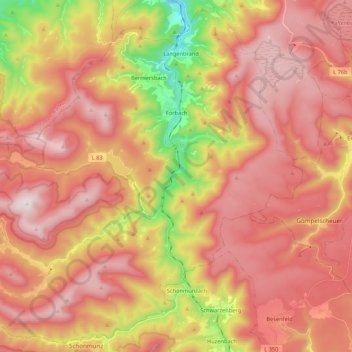
Name: Forbach topographic map, elevation, terrain.

Location: Forbach, Landkreis Rastatt, Baden-Württemberg, 76596, Duitsland (48.58641 8.22207 48.72035 8.43622)

Average elevation: 2,352 ft

Minimum elevation: 659 ft

Maximum elevation: 3,445 ft

Other topographic maps

Click on a map to view its topography, its elevation and its terrain.

Hundsbach

Duitsland > Baden-Württemberg > Landkreis Rastatt > Forbach

Average elevation: 2,608 ft

Gear up for your next adventure:

🪶Paracord Bracelet - Survival bracelet with built‑in tools
📌Outdoor GPS Map App - Apps and devices for digital topographic navigation
👟Trail Running Shoes - Lightweight shoes for trail runners
📚Navigation Handbooks - Master the art of reading topographic maps and using a compass
🔊Portable Camp Speaker - Music and alerts at camp

As an Amazon Associate, this site earns from qualifying purchases at no extra cost to you.