
Sierra Vista Estates topographic map
Interactive map
Click on the map to display elevation.
About this map
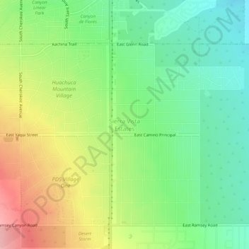
Name: Sierra Vista Estates topographic map, elevation, terrain.
Average elevation: 4,688 ft
Minimum elevation: 4,514 ft
Maximum elevation: 4,948 ft
Other topographic maps
Click on a map to view its topography, its elevation and its terrain.
Miller Peak
United States > Arizona > Cochise County > Sierra Vista
Miller Peak, Sierra Vista, Cochise County, Arizona, United States
Average elevation: 7,881 ft
Fry
United States > Arizona > Cochise County > Sierra Vista
Fry, Sierra Vista, Cochise County, Arizona, 85636, United States
Average elevation: 4,610 ft
Bledsoe
United States > Arizona > Cochise County > Sierra Vista > Bledsoe
Bledsoe, Sierra Vista, Cochise County, Arizona, United States
Average elevation: 6,096 ft