
Thank you for supporting this site ❤️
Make a donation
Make a donation
Gear up for your next adventure:
As an Amazon Associate, this site earns from qualifying purchases at no extra cost to you.
Callén topographic map
Click on the map to display elevation.
Thank you for supporting this site ❤️
Make a donation
Make a donation
Gear up for your next adventure:
As an Amazon Associate, this site earns from qualifying purchases at no extra cost to you.
About this map
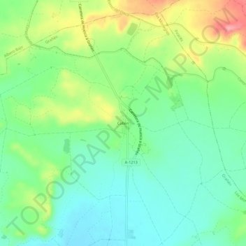
Name: Callén topographic map, elevation, terrain.
Location: Callén, Grañén, Los Monegros, Huesca, Aragón, España (41.97304 -0.38480 42.01304 -0.34480)
Average elevation: 1,234 ft
Minimum elevation: 1,106 ft
Maximum elevation: 1,476 ft
Thank you for supporting this site ❤️
Make a donation
Make a donation
Gear up for your next adventure:
As an Amazon Associate, this site earns from qualifying purchases at no extra cost to you.