
Karaj topographic map
Click on the map to display elevation.
Karaj
One of the international ski resorts of Iran The, Dizin ski resort, is located a few kilometers north-east of the city, in the Alborz. In Dizin, along with skiing facilities, there are tennis courtyards, a slope for skiing on turf, some altitudes for mountain climbing and walking as well as riding and some routes for cycling. Karaj also has an international tennis complex which is used to training and tournaments. Jahanshahr International Tennis Complex is located in Bagh Fateh. This park has eight practice courts and one competition court with a capacity of 1,200 people. It is the only tennis complex in Iran that has covered courts.
About this map
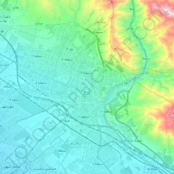
Name: Karaj topographic map, elevation, terrain.
Average elevation: 4,938 ft
Minimum elevation: 3,976 ft
Maximum elevation: 9,409 ft
Other topographic maps
Click on a map to view its topography, its elevation and its terrain.