Geolocate

Patel Nagar topographic map

Click on the map to display elevation.

About this map

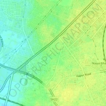
Name: Patel Nagar topographic map, elevation, terrain.

Location: Patel Nagar, Ghaziabad, Uttar Pradesh, 201001, India (28.66602 77.41291 28.68602 77.43291)

Average elevation: 696 ft

Minimum elevation: 663 ft

Maximum elevation: 715 ft

Other topographic maps

Click on a map to view its topography, its elevation and its terrain.

Saffron Park

India > Uttar Pradesh > Ghaziabad

Average elevation: 669 ft

Gear up for your next adventure:

🎒Day Hiking Backpack - Lightweight backpack perfect for day trips and outdoor adventures
🧢Outdoor Hiking Hat - Sun protection hat for outdoor explorers
🔦Powerful Headlamps - Ultra-bright hands-free lighting for night navigation
🔌Solar Panel Charger - Charge gear sustainably outdoors
🚑Emergency Bivvies - Heat-reflective sleeping bags for survival situations

As an Amazon Associate, this site earns from qualifying purchases at no extra cost to you.