
Thank you for supporting this site ❤️
Make a donation
Make a donation
Gear up for your next adventure:
As an Amazon Associate, this site earns from qualifying purchases at no extra cost to you.
Sant'Anna topographic map
Click on the map to display elevation.
Thank you for supporting this site ❤️
Make a donation
Make a donation
Gear up for your next adventure:
As an Amazon Associate, this site earns from qualifying purchases at no extra cost to you.
About this map
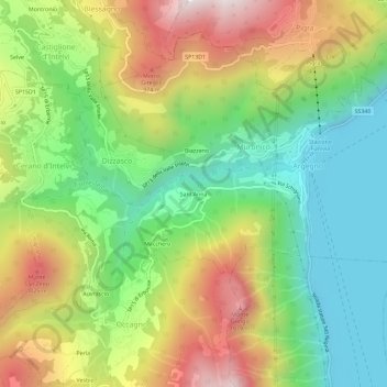
Name: Sant'Anna topographic map, elevation, terrain.
Location: Sant'Anna, Argegno, Como, Lombardia, 22023, Italia (45.92034 9.09112 45.96034 9.13112)
Average elevation: 1,965 ft
Minimum elevation: 600 ft
Maximum elevation: 3,937 ft
Thank you for supporting this site ❤️
Make a donation
Make a donation
Gear up for your next adventure:
As an Amazon Associate, this site earns from qualifying purchases at no extra cost to you.