
Alpnachstad topographic map
Click on the map to display elevation.
About this map
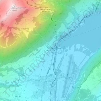
Name: Alpnachstad topographic map, elevation, terrain.
Location: Alpnachstad, Alpnach, Obwalden, 6053, Switzerland (46.93342 8.25434 46.97342 8.29434)
Average elevation: 2,510 ft
Minimum elevation: 1,385 ft
Maximum elevation: 6,663 ft