
Talara topographic map
Click on the map to display elevation.
About this map
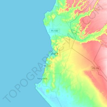
Name: Talara topographic map, elevation, terrain.
Location: Talara, Pariñas, Province of Talara, Piura, Peru (-4.61969 -81.31183 -4.53969 -81.23183)
Average elevation: 138 ft
Minimum elevation: -3 ft
Maximum elevation: 308 ft