
Thank you for supporting this site ❤️
Make a donation
Make a donation
Gear up for your next adventure:
As an Amazon Associate, this site earns from qualifying purchases at no extra cost to you.
Nyaruguru topographic map
Click on the map to display elevation.
Thank you for supporting this site ❤️
Make a donation
Make a donation
Gear up for your next adventure:
As an Amazon Associate, this site earns from qualifying purchases at no extra cost to you.
About this map
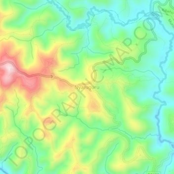
Name: Nyaruguru topographic map, elevation, terrain.
Location: Nyaruguru, Munini, Southern Province, Rwanda (-2.73359 29.51952 -2.69359 29.55952)
Average elevation: 6,207 ft
Minimum elevation: 5,745 ft
Maximum elevation: 6,988 ft
Thank you for supporting this site ❤️
Make a donation
Make a donation
Gear up for your next adventure:
As an Amazon Associate, this site earns from qualifying purchases at no extra cost to you.