Geolocate

Robertsport topographic map

Click on the map to display elevation.

About this map

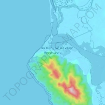
Name: Robertsport topographic map, elevation, terrain.

Location: Robertsport, Commonwealth-C, Grand Cape Mount County, Liberia (6.71257 -11.40695 6.79257 -11.32695)

Average elevation: 72 ft

Minimum elevation: -7 ft

Maximum elevation: 984 ft

Gear up for your next adventure:

🪶Compact Camp Shovel - Folding shovel for campsite tasks
🪶Paracord Bracelet - Survival bracelet with built‑in tools
🏫Relief Map Kits - Hands-on tools for teaching landforms and elevation
🏕️Family Camping Gear - Essentials for group camping trips
Solar GPS Watches - Advanced multisport watches with built-in topographic maps

As an Amazon Associate, this site earns from qualifying purchases at no extra cost to you.