
Thank you for supporting this site ❤️
Make a donation
Make a donation
Gear up for your next adventure:
As an Amazon Associate, this site earns from qualifying purchases at no extra cost to you.
Preda topographic map
Click on the map to display elevation.
Thank you for supporting this site ❤️
Make a donation
Make a donation
Gear up for your next adventure:
As an Amazon Associate, this site earns from qualifying purchases at no extra cost to you.
About this map
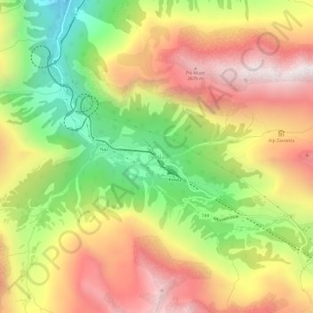
Name: Preda topographic map, elevation, terrain.
Location: Preda, Bergün Filisur, Albula, Graubünden, 7482, Schweiz (46.57043 9.75392 46.61043 9.79392)
Average elevation: 7,005 ft
Minimum elevation: 4,833 ft
Maximum elevation: 9,055 ft
Thank you for supporting this site ❤️
Make a donation
Make a donation
Gear up for your next adventure:
As an Amazon Associate, this site earns from qualifying purchases at no extra cost to you.