
Rajpipla topographic map
Click on the map to display elevation.
Rajpipla
Rajpipla is located at 21°47′N 73°34′E / 21.78°N 73.57°E / 21.78; 73.57. It has an average elevation of 148 metres (485 feet).
About this map
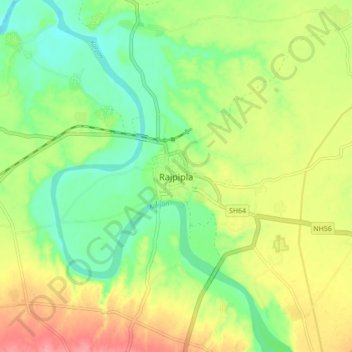
Name: Rajpipla topographic map, elevation, terrain.
Average elevation: 164 ft
Minimum elevation: 46 ft
Maximum elevation: 322 ft