
Chain topographic map
Click on the map to display elevation.
About this map
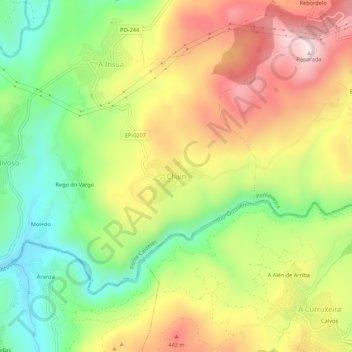
Name: Chain topographic map, elevation, terrain.
Location: Chain, Ponte Caldelas, Pontevedra, Galicia, 36826, Spain (42.33058 -8.53862 42.37058 -8.49862)
Average elevation: 863 ft
Minimum elevation: 66 ft
Maximum elevation: 1,772 ft