Geolocate

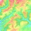
Sankt Thomas topographic map

Click on the map to display elevation.

About this map

Name: Sankt Thomas topographic map, elevation, terrain.

Location: Sankt Thomas, Bitburger Land, Eifelkreis Bitburg-Prüm, Rijnland-Palts, Duitsland (50.05443 6.57671 50.10031 6.62509)

Average elevation: 1,450 ft

Minimum elevation: 919 ft

Maximum elevation: 1,844 ft

Other topographic maps

Click on a map to view its topography, its elevation and its terrain.

Buscht

Duitsland > Rijnland-Palts > Eifelkreis Bitburg-Prüm

Average elevation: 1,234 ft

Gear up for your next adventure:

❄️Traction Cleats - Prevent slips on icy trails during winter hikes
🥘Titanium Cookware - Durable, featherlight pots and pans for backpacking
🏥Hiking First Aid Kits - Comprehensive medical kits for remote trail injuries
🗺️Topographic Maps - Detailed topo maps for hiking, exploring and outdoor navigation
🧼Biodegradable Camping Soap - Eco‑friendly soap for outdoor hygiene

As an Amazon Associate, this site earns from qualifying purchases at no extra cost to you.