Geolocate

Segok-dong topographic map

Click on the map to display elevation.

About this map

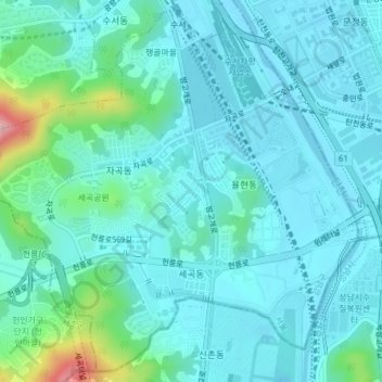
Name: Segok-dong topographic map, elevation, terrain.

Location: Segok-dong, Gangnam-gu, Seoul, South Korea (37.45648 127.08452 37.48521 127.12273)

Average elevation: 141 ft

Minimum elevation: 39 ft

Maximum elevation: 676 ft

Gear up for your next adventure:

🎒Waterproof Dry Bags - Keep your electronics and maps dry inside your pack
🩹Survival Bandages - High‑quality bandages for emergencies
GPS Sports Watch - GPS watch for running, hiking and training
🧤Tactile Hiking Gloves - Keep hands warm while operating GPS and smartphone screens
🧷Carabiner Set - Durable clips for gear attachment

As an Amazon Associate, this site earns from qualifying purchases at no extra cost to you.