
Thank you for supporting this site ❤️
Make a donation
Make a donation
Gear up for your next adventure:
As an Amazon Associate, this site earns from qualifying purchases at no extra cost to you.
Chaupe topographic map
Click on the map to display elevation.
Thank you for supporting this site ❤️
Make a donation
Make a donation
Gear up for your next adventure:
As an Amazon Associate, this site earns from qualifying purchases at no extra cost to you.
About this map
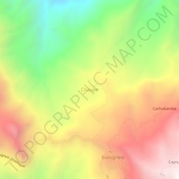
Name: Chaupe topographic map, elevation, terrain.
Location: Chaupe, Bolognesi, Pallasca, Áncash, Perú (-8.35521 -78.07593 -8.31521 -78.03593)
Average elevation: 8,599 ft
Minimum elevation: 6,204 ft
Maximum elevation: 10,945 ft
Thank you for supporting this site ❤️
Make a donation
Make a donation
Gear up for your next adventure:
As an Amazon Associate, this site earns from qualifying purchases at no extra cost to you.