
Thank you for supporting this site ❤️
Make a donation
Make a donation
Gear up for your next adventure:
As an Amazon Associate, this site earns from qualifying purchases at no extra cost to you.
Haut-Rhin topographic map
Click on the map to display elevation.
Thank you for supporting this site ❤️
Make a donation
Make a donation
Gear up for your next adventure:
As an Amazon Associate, this site earns from qualifying purchases at no extra cost to you.
About this map
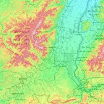
Name: Haut-Rhin topographic map, elevation, terrain.
Location: Haut-Rhin, Grand Est, Metropolitan France, France (47.42034 6.84132 48.31134 7.62201)
Average elevation: 1,457 ft
Minimum elevation: 509 ft
Maximum elevation: 4,567 ft
Thank you for supporting this site ❤️
Make a donation
Make a donation
Gear up for your next adventure:
As an Amazon Associate, this site earns from qualifying purchases at no extra cost to you.