Geolocate

Solo topographic map

Click on the map to display elevation.

About this map

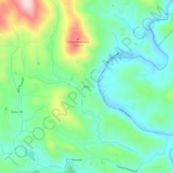
Name: Solo topographic map, elevation, terrain.

Location: Solo, Watauga County, North Carolina, 28684, United States (36.26207 -81.63761 36.30207 -81.59761)

Average elevation: 3,297 ft

Minimum elevation: 2,949 ft

Maximum elevation: 4,160 ft

Watauga County trails, hiking, mountain biking, running and outdoor activities

Gear up for your next adventure:

🧭Compass with Lanyard - Easy‑carry compass for navigation
🎁Geography Themed Gifts - Unique gift ideas for map lovers and geography enthusiasts
🥇GPS Hiking Watch - Multi‑sport GPS watch with navigation and trail tracking
📱Solar Portable Charger - Solar power bank for charging devices off‑grid
🛰️Handheld GPS Units - Professional satellite navigators for precise backcountry mapping

As an Amazon Associate, this site earns from qualifying purchases at no extra cost to you.