
Thank you for supporting this site ❤️
Make a donation
Make a donation
Gear up for your next adventure:
As an Amazon Associate, this site earns from qualifying purchases at no extra cost to you.
Ojochuanan topographic map
Click on the map to display elevation.
Thank you for supporting this site ❤️
Make a donation
Make a donation
Gear up for your next adventure:
As an Amazon Associate, this site earns from qualifying purchases at no extra cost to you.
About this map
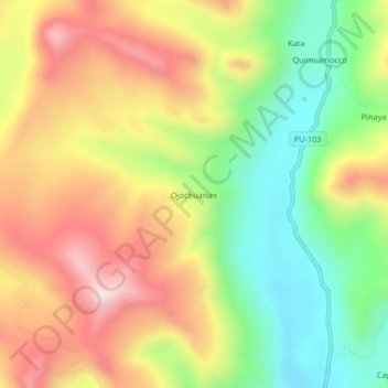
Name: Ojochuanan topographic map, elevation, terrain.
Location: Ojochuanan, Ajoyani, Province of Carabaya, Puno, Peru (-14.16988 -70.23677 -14.12988 -70.19677)
Average elevation: 15,351 ft
Minimum elevation: 14,393 ft
Maximum elevation: 16,394 ft
Thank you for supporting this site ❤️
Make a donation
Make a donation
Gear up for your next adventure:
As an Amazon Associate, this site earns from qualifying purchases at no extra cost to you.