
Thank you for supporting this site ❤️
Make a donation
Make a donation
Gear up for your next adventure:
As an Amazon Associate, this site earns from qualifying purchases at no extra cost to you.
Dumi topographic map
Click on the map to display elevation.
Thank you for supporting this site ❤️
Make a donation
Make a donation
Gear up for your next adventure:
As an Amazon Associate, this site earns from qualifying purchases at no extra cost to you.
About this map
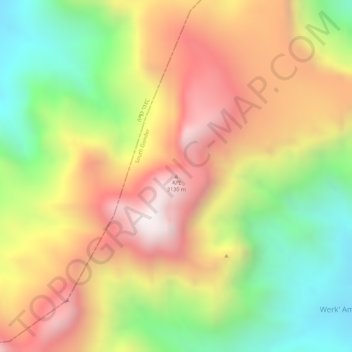
Name: Dumi topographic map, elevation, terrain.
Location: Dumi, Werk' Amba, South Gonder, Amhara Region, Ethiopia (12.24739 37.84092 12.24749 37.84102)
Average elevation: 8,996 ft
Minimum elevation: 7,638 ft
Maximum elevation: 10,217 ft
Thank you for supporting this site ❤️
Make a donation
Make a donation
Gear up for your next adventure:
As an Amazon Associate, this site earns from qualifying purchases at no extra cost to you.