
Make a donation
Gear up for your next adventure:
As an Amazon Associate, this site earns from qualifying purchases at no extra cost to you.
Schloß Alerheim topographic map
Click on the map to display elevation.
Make a donation
Gear up for your next adventure:
As an Amazon Associate, this site earns from qualifying purchases at no extra cost to you.
Schloß Alerheim
Schloss Alerheim, auch Burgruine Alerheim genannt, ist die Ruine einer Höhenburg zusammen mit neueren Gebäuden im Weiler Schloßruine der Gemeinde Alerheim im schwäbischen Landkreis Donau-Ries in Bayern. Es liegt auf einem Hügel, dem „Schlossberg“, bei 455,4 m ü. NHN im Westen des Ortes.
Make a donation
Gear up for your next adventure:
As an Amazon Associate, this site earns from qualifying purchases at no extra cost to you.
About this map
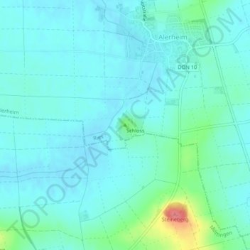
Name: Schloß Alerheim topographic map, elevation, terrain.
Average elevation: 1,391 ft
Minimum elevation: 1,345 ft
Maximum elevation: 1,604 ft
Make a donation
Gear up for your next adventure:
As an Amazon Associate, this site earns from qualifying purchases at no extra cost to you.