Geolocate

Citeureup topographic map

Click on the map to display elevation.

About this map

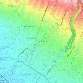
Name: Citeureup topographic map, elevation, terrain.

Location: Citeureup, Cimahi, West Java, Java, 40512, Indonesia (-6.88105 107.52752 -6.84105 107.56752)

Average elevation: 2,671 ft

Minimum elevation: 2,408 ft

Maximum elevation: 3,225 ft

Other topographic maps

Click on a map to view its topography, its elevation and its terrain.

Cimahi

Indonesia > West Java > Cimahi > Baros

Average elevation: 2,346 ft

Gear up for your next adventure:

🪓Survival Multi‑Tool - Versatile tool for camp and trail tasks
🧦Merino Wool Socks - Moisture-wicking, blister-preventing socks for long treks
🪶Wildlife Field Guides - Learn animal tracking and species ID
🎒Trail Energy Bars - High‑calorie bars for hiking energy
🚑Emergency Bivvies - Heat-reflective sleeping bags for survival situations

As an Amazon Associate, this site earns from qualifying purchases at no extra cost to you.