
Thank you for supporting this site ❤️
Make a donation
Make a donation
Gear up for your next adventure:
As an Amazon Associate, this site earns from qualifying purchases at no extra cost to you.
Kase topographic map
Click on the map to display elevation.
Thank you for supporting this site ❤️
Make a donation
Make a donation
Gear up for your next adventure:
As an Amazon Associate, this site earns from qualifying purchases at no extra cost to you.
About this map
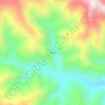
Name: Kase topographic map, elevation, terrain.
Location: Kase, Buru Selatan, Moluccas, Indonesia (-3.75414 126.57420 -3.71414 126.61420)
Average elevation: 1,837 ft
Minimum elevation: 732 ft
Maximum elevation: 3,458 ft
Thank you for supporting this site ❤️
Make a donation
Make a donation
Gear up for your next adventure:
As an Amazon Associate, this site earns from qualifying purchases at no extra cost to you.