Geolocate

Oak Ridge topographic map

Click on the map to display elevation.

About this map

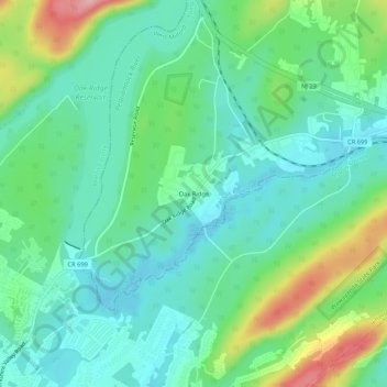
Name: Oak Ridge topographic map, elevation, terrain.

Location: Oak Ridge, West Milford, Passaic County, New Jersey, 07438, United States (41.02621 -74.50599 41.06621 -74.46599)

Average elevation: 909 ft

Minimum elevation: 771 ft

Maximum elevation: 1,266 ft

Passaic County trails, hiking, mountain biking, running and outdoor activities

Other topographic maps

Click on a map to view its topography, its elevation and its terrain.

Hewitt

United States > New Jersey > Passaic County > West Milford

Average elevation: 755 ft

Gear up for your next adventure:

🧤Hiking Gloves - Protective gloves for rugged trails
🔪Outdoor Multitools - Essential survival tools for gear repair and field use
🦶Carbon Trekking Poles - Reduce knee impact on steep descents with ultra-light poles
🥾Women's Hiking Boots - Top-rated trail boots with ankle support and superior grip
🎒Gear Packing Cubes - Organize your backpack efficiently

As an Amazon Associate, this site earns from qualifying purchases at no extra cost to you.