
Make a donation
Gear up for your next adventure:
As an Amazon Associate, this site earns from qualifying purchases at no extra cost to you.
Diamond Lake topographic map
Click on the map to display elevation.
Make a donation
Gear up for your next adventure:
As an Amazon Associate, this site earns from qualifying purchases at no extra cost to you.
About this map
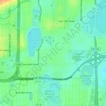
Name: Diamond Lake topographic map, elevation, terrain.
Average elevation: 846 ft
Minimum elevation: 804 ft
Maximum elevation: 932 ft
Hennepin County trails, hiking, mountain biking, running and outdoor activities
Make a donation
Gear up for your next adventure:
As an Amazon Associate, this site earns from qualifying purchases at no extra cost to you.
Other topographic maps
Click on a map to view its topography, its elevation and its terrain.
Minneapolis
United States > Minnesota > Hennepin County > Minneapolis
A 1959 report by the U.S. Soil Conservation Service listed Minneapolis's elevation as 830 feet (250 m). The city's lowest elevation of 687 feet (209 m) above sea level is near where Minnehaha Creek meets the Mississippi River. Sources disagree on the exact location and elevation of the city's highest point,…
Average elevation: 889 ft
Minnehaha Falls
United States > Minnesota > Hennepin County > Minneapolis
Fortunately for the generations to come, in 1883 the state legislature created the Minneapolis Board of Park Commissioners. The board began by acquiring park land near today's downtown Minneapolis. Their choice to hire noted landscape architect Horace Cleveland was fortunate. Cleveland was hired by the Board…
Average elevation: 817 ft
North Commons Park
United States > Minnesota > Hennepin County > Minneapolis
Average elevation: 876 ft