
Thank you for supporting this site ❤️
Make a donation
Make a donation
Gear up for your next adventure:
As an Amazon Associate, this site earns from qualifying purchases at no extra cost to you.
Dhar topographic map
Click on the map to display elevation.
Thank you for supporting this site ❤️
Make a donation
Make a donation
Gear up for your next adventure:
As an Amazon Associate, this site earns from qualifying purchases at no extra cost to you.
About this map
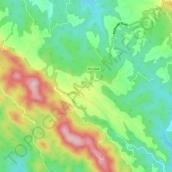
Name: Dhar topographic map, elevation, terrain.
Location: Dhar, Dhar Kalan Tahsil, Pathankot district, Punjab, India (32.38290 75.79670 32.42290 75.83670)
Average elevation: 1,946 ft
Minimum elevation: 1,621 ft
Maximum elevation: 2,461 ft
Thank you for supporting this site ❤️
Make a donation
Make a donation
Gear up for your next adventure:
As an Amazon Associate, this site earns from qualifying purchases at no extra cost to you.