Geolocate

Miramar topographic map

Click on the map to display elevation.

About this map

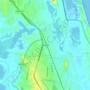
Name: Miramar topographic map, elevation, terrain.

Location: Miramar, Altamira, Tamaulipas, 89604, Mexico (22.29317 -97.91104 22.37317 -97.83104)

Average elevation: 30 ft

Minimum elevation: -10 ft

Maximum elevation: 174 ft

Gear up for your next adventure:

🪶Survival Guide Book - Expert advice for emergency preparedness
🔋Rechargeable Batteries - Power up your outdoor devices
🏔️Mountain Trail Maps - High‑detail maps for popular peaks
🔥Camping Stove - Portable stove for camping and backcountry cooking
🥾Women's Hiking Boots - Top-rated trail boots with ankle support and superior grip

As an Amazon Associate, this site earns from qualifying purchases at no extra cost to you.