
Thank you for supporting this site ❤️
Make a donation
Make a donation
Gear up for your next adventure:
As an Amazon Associate, this site earns from qualifying purchases at no extra cost to you.
Tioga topographic map
Click on the map to display elevation.
Thank you for supporting this site ❤️
Make a donation
Make a donation
Gear up for your next adventure:
As an Amazon Associate, this site earns from qualifying purchases at no extra cost to you.
About this map
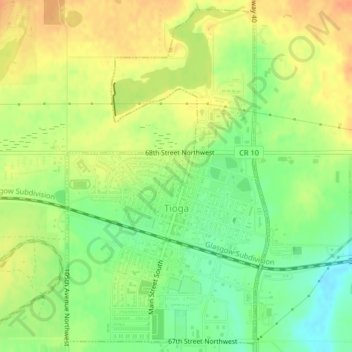
Name: Tioga topographic map, elevation, terrain.
Location: Tioga, Williams County, North Dakota, 58852, United States (48.37976 -102.97262 48.41414 -102.90742)
Average elevation: 2,274 ft
Minimum elevation: 2,188 ft
Maximum elevation: 2,411 ft
Williams County trails, hiking, mountain biking, running and outdoor activities
Thank you for supporting this site ❤️
Make a donation
Make a donation
Gear up for your next adventure:
As an Amazon Associate, this site earns from qualifying purchases at no extra cost to you.