
Haselbach topographic map
Click on the map to display elevation.
About this map
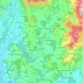
Name: Haselbach topographic map, elevation, terrain.
Average elevation: 1,470 ft
Minimum elevation: 1,070 ft
Maximum elevation: 2,635 ft
Other topographic maps
Click on a map to view its topography, its elevation and its terrain.
Unterlindberg
Deutschland > Bayern > Landkreis Straubing-Bogen > Perasdorf
Average elevation: 1,913 ft
Niederlindhart
Deutschland > Bayern > Landkreis Straubing-Bogen > Mallersdorf-Pfaffenberg > Westen
Average elevation: 1,335 ft
Bogenberg
Deutschland > Bayern > Landkreis Straubing-Bogen > Bogen > Bogenberg
Average elevation: 1,070 ft
Herrnfehlburg
Deutschland > Bayern > Landkreis Straubing-Bogen > Rattiszell
Average elevation: 1,463 ft
Lauterbach
Deutschland > Bayern > Landkreis Straubing-Bogen > Niederwinkling
Average elevation: 1,122 ft
Irlbach an der Donau
Deutschland > Bayern > Landkreis Straubing-Bogen > Irlbach
Average elevation: 1,053 ft
Untermühlbach
Deutschland > Bayern > Landkreis Straubing-Bogen > Obermühlbach
Average elevation: 1,565 ft
St. Leonhardsquelle
Deutschland > Bayern > Landkreis Straubing-Bogen > Mitterberg
Average elevation: 2,651 ft
Hinterdegenberg
Deutschland > Bayern > Landkreis Straubing-Bogen > Allersdorf
Average elevation: 1,896 ft
Semmersdorf
Deutschland > Bayern > Landkreis Straubing-Bogen > Leimbühlholz
Average elevation: 1,611 ft
Westen
Deutschland > Bayern > Landkreis Straubing-Bogen > Mallersdorf-Pfaffenberg
Average elevation: 1,345 ft
Niederpiebing
Deutschland > Bayern > Landkreis Straubing-Bogen > Oberpiebing
Average elevation: 1,201 ft
Grafentraubach
Deutschland > Bayern > Landkreis Straubing-Bogen
Das Pfarrdorf Grafentraubach liegt im Donau-Isar-Hügelland auf Höhen um 372 m ü. NHN am linken Rand des Tals der Kleinen Laber. Durch den Ort mündet der Grafentraubach in den Mittellauf des Flusses. Etwas über zwei Kilometer östlich liegt am anderen Rand der Flusstalaue der Gemeindesitz Laberweinting,…
Average elevation: 1,280 ft
Oberholzen
Deutschland > Bayern > Landkreis Straubing-Bogen > Geiselhöring
Average elevation: 1,224 ft
Kastenfeld
Deutschland > Bayern > Landkreis Straubing-Bogen > Scheibelsgrub
Average elevation: 1,365 ft
Sallach
Deutschland > Bayern > Landkreis Straubing-Bogen > Geiselhöring > Sallach
Average elevation: 1,220 ft
Vorderschida
Deutschland > Bayern > Landkreis Straubing-Bogen > Vorderschida
Average elevation: 1,201 ft
Obermühlbach
Deutschland > Bayern > Landkreis Straubing-Bogen > Obermühlbach
Average elevation: 1,759 ft
Wullendorf
Deutschland > Bayern > Landkreis Straubing-Bogen > Wiesenfelden
Average elevation: 1,798 ft
Talmühle
Deutschland > Bayern > Landkreis Straubing-Bogen > Scheibelsgrub > Talmühle
Average elevation: 1,339 ft